![]()
![]()
reseach
Replicating a City in Cyberspace! Creating a Safe and Secure Life in the Future using Measurement Technologies
Ryuichi Imai, Professor
Department of Civil and Environmental Engineering, Faculty of Engineering and Design
Posted Apr.8,2024
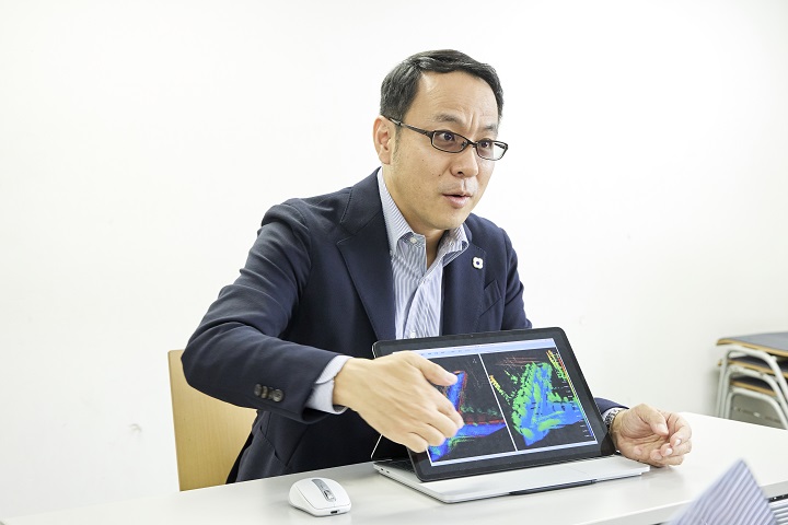
Explain the major details of your current research
The major themes of my research are the “development of measurement and management methods for national space (or geospace)” and the “analysis and visualization of urban activities.” With regard to the “development of measurement and management methods for national space (or geospace),” we are engaging in building a digital twin, which replicates a 3D city in cyberspace by three-dimensionally measuring the terrain by firing a laser from a plane.
As for the “analysis and visualization of urban activities,” we are examining a method to measure the flow of people and traffic volume in cities by leveraging deep learning based on Big Data acquired using mobile phone movement data, cameras and sensors. Both are crucial research that have been selected to be national projects.
Explain what research results, if any, are being applied in society
One result that is being applied in society is the analysis of data regarding the flow of people using mobile phone movement data. This research was triggered from experiences gained when tackling the development of digital maps at the National Institute for Land and Infrastructure Management, at the Ministry of Land, Infrastructure, Transport and Tourism (MLIT). At the time, I frequently used the Shinkansen bullet train when I traveled on business. One time, I noticed that my mobile phone battery drained rather quickly while I was riding the Shinkansen. Assuming this was due to switching base stations that relay radio waves while moving through different areas, by using this data, I thought it would be possible to use this to estimate the flow of people. Accordingly, in 2014 joint research was launched with NTT DOCOMO, INC. This led to the commercial use of people-flow data in 2018. This technology was used to analyze the movement of people during COVID-19. It has received a lot of attention.
Moreover, surveys of traffic volume, which are necessary for road plans, were previously carried out manually by people. The automation of this through the use of cameras and AI is being realized. Initially, there was a low level of recognition accuracy using AI therefore traffic volume was not accurately grasped. My research group conducted a survey and analysis, and boosted performance to a practical level. In particular, during the nighttime, vehicle identification is difficult, therefore measurement precision substantially declines. This is a problem. This issue was resolved using AI by replacing the nighttime footage with pseudo daytime footage. This has made it possible to survey traffic volume throughout the entire day.
When do you find your research to be rewarding?
There is a feeling of great joy when the results of our research are practically implemented in society. The research I am conducting always aims to be implemented in society. When a student that belongs to my research department produces a result, I am elated. Students also participate in research that is on the scale of a national project. Among these projects, the research that I am engaged is helpful to society and I hope it will contribute to the future.
Going forward, should you continue to develop your research, what will you be able to achieve?
At present, Japan is promoting “Society 5.0,” a system that aims to integrate cyberspace and physical space. My research has largely contributed to the realization of Society 5.0. By building a digital twin that is established through the measurement of the national land in detail, the technology will enable minute changes in geographic formations. This will facilitate the prevention of disasters, including levee breaches and landslides. Through the use of people-flow data and the automatic measurement of traffic volume, it will likely be possible to efficiently control the mobility of people and vehicles.
In addition, to realize a compact city with a more efficient living space due to a declining birthrate and aging population, the transportation infrastructure needs to be downsized, including bridges* which are not frequently used. In a case such as this, it will be easier to form a consensus and make decisions by using people-flow data. In this manner, I believe cyberspace will play the role of a city operator that controls a city.
*Structures built, including those that cross rivers, valleys and lakes, or which intersect 3-dimensionally, including railways and roads.
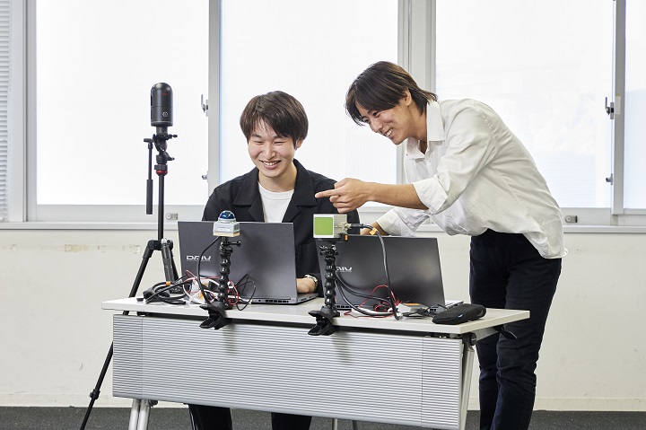
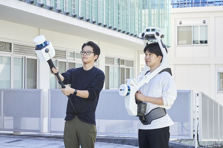
[Column] Underlying factors for measurements
Thanks to the cooperation of Prof. Imai’s research laboratory, we will introduce recent measurement devices!
The device located in front of the two computers is a laser. Features include it being compact and low price. The device can measure in a 360-degree horizontal direction on the left and up to several hundred meters away on the right side. This device is primarily loaded onto a vehicle and used for autonomous driving.
The laser device makes measuring possible while moving about, give a monopod is attached to each respective main body and as the device can be carried on one’s back. A feature is that on the right, it is possible to take photographs simultaneously and on the left, it can add location information using satellite positioning. Apparently the device does not feel heavy as long has measurements are conducted over a short time.
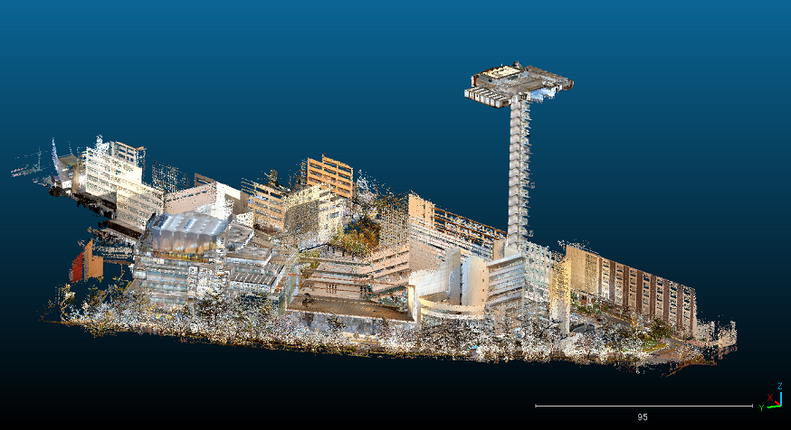
Digitalized Hosei University Ichigaya Campus
This is the result of measurements using a device that can be carried on one’s back. Images are photographed, after which the data is colorized. Three students that are members of Prof. Imai’s research laboratory took three days to measure the campus, including the school buildings. The results were great, making it possible to give tours of the campus using a digital space.
Realize Future Dream through Research
We anticipate this will make it possible to efficiently and intensively design an urban space for the future that will be easy to live in by leveraging digital twin and people-flow data technologies. In light of this, going forward, even if there continues to be a low birth rate and aging society, we aim to create an environment where anyone can live securely and safely.
Ryuichi Imai, Professor
Department of Civil and Environmental Engineering, Faculty of Engineering and Design
Completed his master’s degree in 2000 at the Graduate School of Science and Engineering, Kansai University. After receiving a doctorate at the University of Tokyo (Engineering), was hired at a construction consulting company. After a stint at the National Institute for Land and Infrastructure Management, at MLIT, held various positions, including as an associate professor at Tokyo City University, and in 2019 he became an associate professor at the Faculty of Engineering and Design at Hosei University. He has held his current position since October 2020.